Climate change affects everyone differently. As poet Damian Barr famously wrote, “We are not all in the same boat. We are all in the same storm. Some are on super-yachts. Some have just the one oar.”
Barr originally penned this line about the pandemic, but power and privilege are deeply influential factors which affect a person’s experiences of climate change.
Equity deserving groups are most likely to live in the areas of highest climate vulnerability within their communities. They are also least likely to be supported by features like green infrastructure that can lessen the impact of climate events including floods and heat waves. This pattern repeats itself across the country and reflects economic, environmental and social disparities that often fall across racial lines.
Green infrastructure plays an important role to support physical and mental health within our communities, and contributes to climate resilience through urban cooling, nurturing biodiversity and reducing floods. This is why our Living Cities Canada Framework advocates for our cities to address green infrastructure gaps for equity deserving groups.
Creating maps of existing green spaces in Canadian cities before undertaking green infrastructure projects is helpful in this regard. GCC has been enabling our Living Cities Canada Fund Transform Stream partners to develop such maps to help bring equity into green infrastructure planning and implementation in our cities.
Read on to learn why mapping is an important tool, and how our projects include mapping as a part of their process to improve equitable access to green spaces.
Mapping as a Tool for Developing Equitable Green Infrastructure
Creating an equitable city requires data informed decision-making to understand the spatial distribution of challenges, and plan for integrating green infrastructure projects in the areas that need it the most. By harnessing the appropriate data, much of which is publicly available, maps can be developed which layer and display:
- Existing green infrastructure (e.g., percentage of greenness, canopy cover, parklands, etc.)
- Demographics (e.g., percentage of visible minorities, median income, etc.)
- Climate vulnerability (e.g., urban heat, floodplains etc.)
These maps can then be used to identify the intersections of various criteria mentioned above to determine priority locations for action. This process of mapping and prioritizing ’hotspots’ is called spatial multi-criteria decision analysis (MCDA) and is increasingly being used to help make urban planning decisions that aim to resolve social and environmental problems.
Equity Mapping for Green Infrastructure Planning
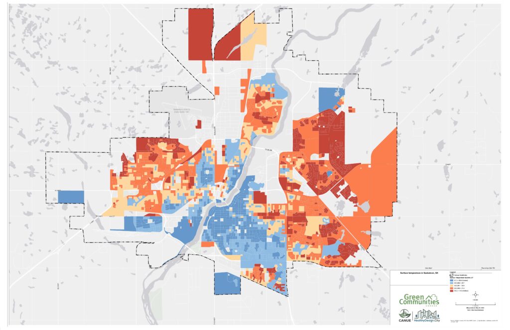
Map showing surface temperature in communities across Saskatoon, SK
In early 2023, Green Communities Canada collaborated with the HealthyDesign.City and Partners for Action initiatives to develop a series of static maps for the 11 communities working on projects as part of the Transform Stream of the Living Cities Canada Fund.
The purpose of this exercise was to better understand where the greatest disparities in each community were, and to prioritize outreach within these communities to advance green infrastructure action projects in priority neighbourhoods over the next year.
The resulting maps identify the intersections of three environmental factors (greenness, land surface temperature, and flooding susceptibility) and one sociodemographic factor (low-income visible minority individuals) for small areas within the 11 participating communities to help prioritize action in the neighbourhoods of greatest need.
These maps also offer a starting point for our local partners as they perform outreach activities and identify which communities to engage to design large-scale green infrastructure projects planned for 2024.
Canadians across the country can access and interpret similar data using the HealthyPlan.City web application, an interactive mapping tool developed by HealthyDesign.City that allows users to identify areas within cities where environmental inequity exists and advocate for change.
Democratizing Green Infrastructure Planning
An equitable approach to green infrastructure involves not only identifying and prioritizing under-natured areas, but also listening to and involving members of underserved communities who are most affected by the lack of existing green infrastructure as well as new projects.
Even though new green infrastructure projects are undertaken with ‘best intentions’, they could inadvertently cause harm through green gentrification — the process by which new green spaces lead to the displacement of local populations in equity deserving neighbourhoods — if local communities are excluded from the planning process.
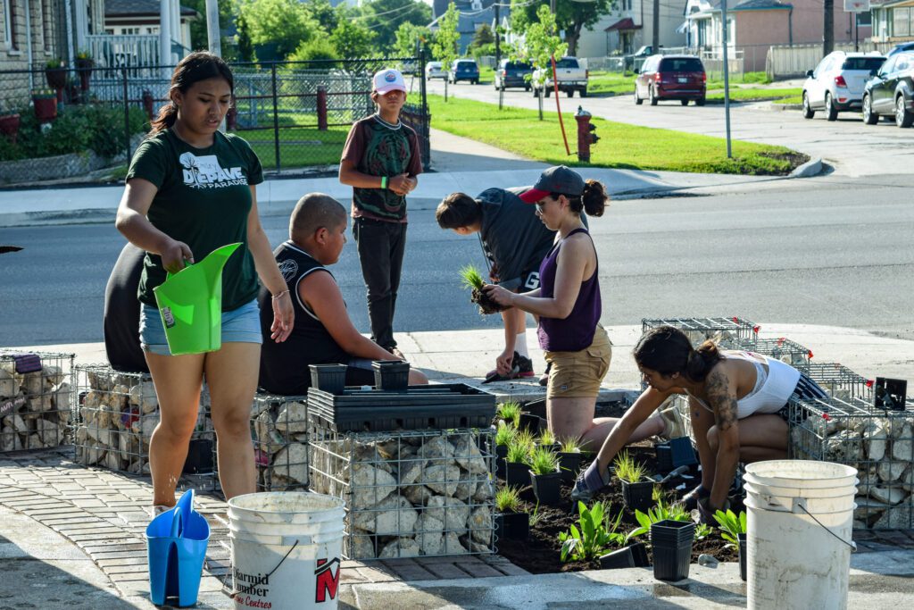
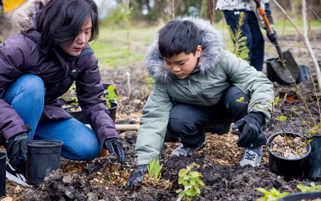
People participating in a planting event at Rossbrook House, Winnipeg.
The democratization of the planning process requires engaging the community in an early phase of project development. This helps us understand the needs and issues faced by communities and ensure community voices have the opportunity to shape project design.
While targeting the development of green infrastructure in the most under-natured communities is the best practice, these communities may have more imminent concerns (e.g., food security, inadequate shelter, employment stability). It is important that local organizations aiming to partner and work with these communities have adequate training in equity, diversity and inclusion.
In recognition of this, GCC engaged consultants from Cambium Indigenous Professional Services, Anemochory Consulting, and Montreal Urban Ecology Centre, to conduct trainings for the Transform stream partners on how best to develop engagement sessions, and plan outreach and co-design activities explicitly targeting traditionally underrepresented voices.
Investment in green infrastructure can be part of a broader strategy to bring about substantial local changes, not only in the resilience of the landscape but also in empowering communities to take a greater role in stewarding neighbourhood change. We’re proud to support 11 communities over the next two years to develop these transformative projects through a thoughtful process that puts equity in the forefront of all our activities.
The Transform Stream of the Living Cities Canada Fund is generously supported by TD Ready Challenge and Definity Insurance Foundation.
Trackbacks/Pingbacks