

In 2021, more than $2B of damage was recorded in Canada due to severe weather events. Aging and poorly maintained stormwater infrastructure, paired with increased severity and duration of rain events, puts communities at a greater risk of high water levels than ever before.
Many Indigenous communities across Canada are affected by seasonal flooding. In spring of 2022 alone, there were evacuations in many First Nations Communities in Ontario, Manitoba, Alberta, and BC, and a recent study by the University of Waterloo identified 40 flood risk hotspots in Indigenous Communities across Canada. Establishing accurate floodplain maps allows communities to take a proactive approach to flooding by reducing development in high-risk areas and establishing emergency protocols for high-water-level events.
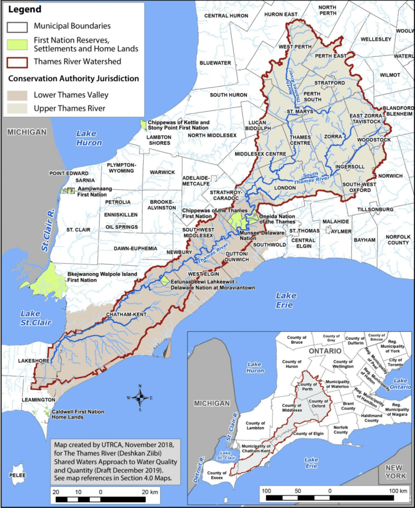
A collaboration between Chippewas of the Thames First Nation, Green Communities Canada, Lower Thames Valley Conservation Authority, Cambium Indigenous Professional Services, Conservation Ontario, and Canadian Environmental Law Association has been developing floodplain maps and floodplain education for First Nations along the banks of DeshkanZiibi (Thames River) over the past two years. The initiative was made possible with funding from the federal First Nation Adapt program and delivered with involvement from Onieda First Nation of the Thames, Munsee-Deleware Nation, and Moraviatown First Nation. This project followed another very successful collaboration in the region; the shared waters approach – a watershed management plan that was developed through the Thames River Clear Water Revival Project.
The Chippewas of the Thames First Nation flood plain mapping project was, at its heart, an Indigenous-led conservation initiative, which combined technical knowledge and skills with the rich Traditional Ecological Knowledge (TEK) available within the local First Nation communities. The project also aimed to provide education for the community and for First Nations and environmental practitioners looking for positive partnership models beyond these regions.
In 2021, five community workshops were organized to share the results of ongoing monitoring, and gather feedback and share important perspectives from the Chippewas, Oneida, Moraviatown, and Munsee Nations who live along DeshkanZiibi (Thames River). Then, in 2022, the learnings from this project were shared more broadly through a five-part online webinar series.
Each session began and ended with traditional acknowledgements, songs, and teachings, and infused local community perspectives with technical developments in the floodplain mapping project. Over 500 attendees, including members of Indigenous communities and environmental professionals, were able to ask questions and learn firsthand about developing their own floodplain mapping projects, successful protocols, and effective partnership approaches.
While the climate risks to Indigenous communities in remote and flood-vulnerable locations continue to increase, programs such as these provide an opportunity to build local capacity and resiliency in the event of an emergency. And more importantly, they reinforce the value and importance of partnership models that engage in research with, and alongside, instead of for Indigenous communities.