The purpose of this resource is to help families identify and follow safe walking and cycling routes to school. Wayfinding signs can also alert drivers to watch out for students along popular routes.
Description
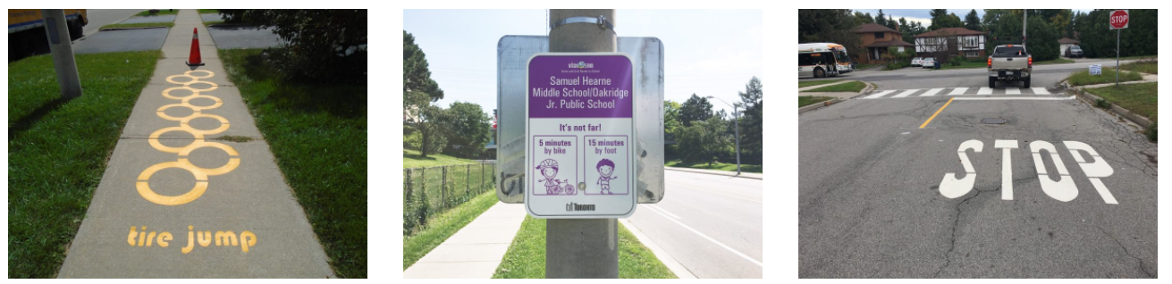
Installation of street signs along popular routes to school, showing which way to go and the distance/journey time to get to school. Wayfinding signage can be enhanced by adding paint markings on sidewalks to increase visibility and engage young children (e.g., playful words and games).
Wayfinding is only recommended for schools that have a high proportion of students who live within walking distance (up to 3 km from school) to make use of the initiative. Any traffic safety issues on the routes to school need to be addressed before implementing a wayfinding initiative (e.g., lack of sidewalks and/or safe crossings for pedestrians).
The main steps to implementing Wayfinding include:
- Consulting students and parents to determine which routes to school should be highlighted by Wayfinding
- Working with municipal partners to design and install the street signs and pavement markings
- Outreach to parents, students, and the broader community surrounding the school to promote the wayfinding initiative along the new routes
Wayfinding can be linked with other encouragement initiatives, including Routes to School Mapping, Walking School Bus, and Drive to Five.
What you will need
- Support from your municipality and other local partners to fund, plan, install and maintain the signs and paint markings.
- Data to inform where the routes should go, including information about:
1) How many students live within walking and cycling distance of the school;
2) Current travel mode share e.g. by conducting a Student Travel Survey;
3) Popular walking and cycling routes;
4) Location of crossing guards, pedestrian crossings, sidewalks, bike lanes and multi-use trails in your school neighbourhood; and
5) Areas of concern to be addressed before wayfinding is installed, e.g., by conducting a Family Travel Survey, Walkabout, and/or Bikeabout.
Who can help
Municipality (Transportation Planning and Public Works staff), public health, student transportation services, police services, and local community/neighbourhood associations.
The Active and Safe Routes to School Project’s Wayfinding page explains how school wayfinding signs work, their benefits for students, and the associated costs. It also links to a toolkit and summary for schools interested in implementing a signage program.
Key words
Signs, paint markings, route, path, wayfinding, community, map, sidewalk, street, neighbourhood, direction, destination, journey time, distance.